
Surveying · Telford, Shropshire
Drone Photogrammetry & 3D Site Modelling – Telford
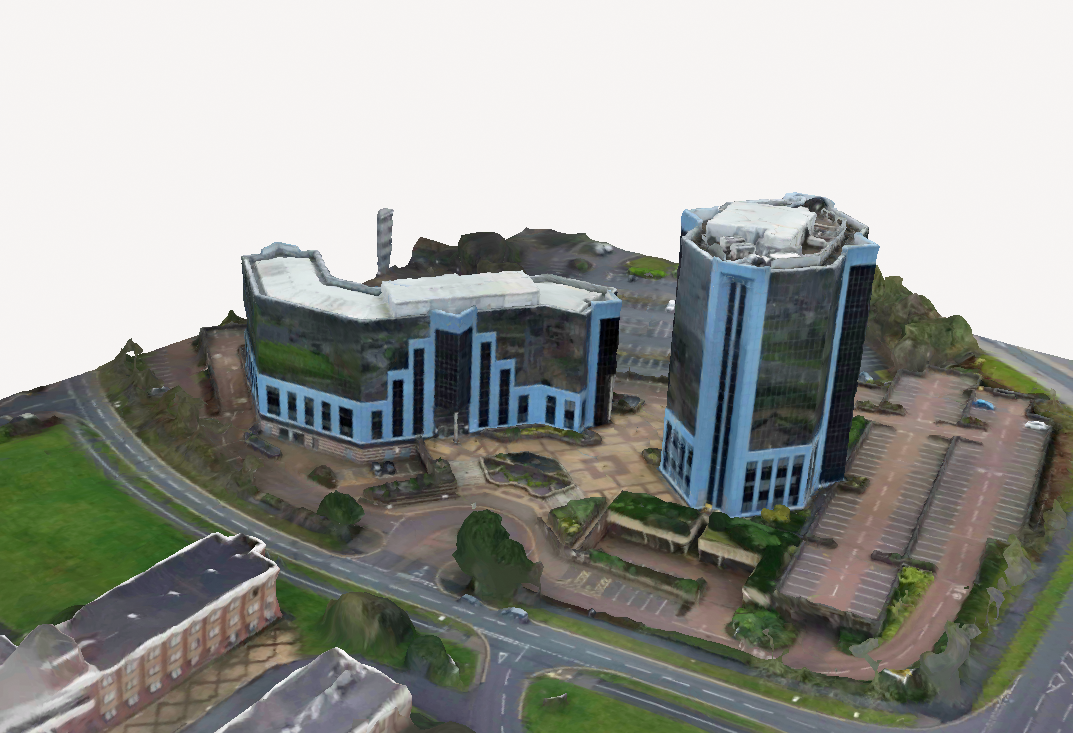
Overlapping aerial photographs of a commercial site were processed into a three-dimensional photogrammetry model. The resulting visual record brings together the overall building forms, roof arrangements, surrounding roads, car parking and site context to support exploration from different viewpoints.
PROJECT OVERVIEW
The project
Overlapping aerial photographs of a commercial site were processed into a three-dimensional photogrammetry model. The resulting visual record brings together the overall building forms, roof arrangements, surrounding roads, car parking and site context to support exploration from different viewpoints.
Outcome
A three-dimensional model of the existing site was produced as a digital survey and visualisation exercise. It should not be presented as a precision measured survey without independent accuracy verification.
THE DETAIL
Key features
- Drone photography and photogrammetry-based modelling
- Visual documentation of buildings and roof structures
- Context including nearby roads and parking
- Digital model to help understand site arrangements
- Illustration of applications for feasibility and early design
Related services
Have a similar project in mind?
Tell us about your plans and we can discuss suitable drawing, planning and technical support.